



Maverick
GPS Navigation

Descripción de Maverick: GPS Navigation
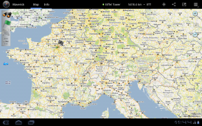
Use offline maps and GPS even without an internet connection. This app is great for hiking, boating, geocaching and other outdoor activities.
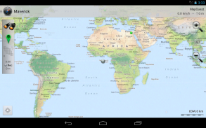
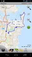
• Multiple global and regional online maps, including: Bing, Yandex, Open Street Maps, OSM Cycle, OSM Public Transport, Multimap (UK), OutdoorActive (Germany, Austria, South Tyrol), Cykloatlas, HikeBikeMap (Germany), Open Piste Map, NearMap (Australia) and many other maps.
All maps automatically cached for offline use. Use Mobile Atlas Creator to download maps or MAPC2MAPC to convert maps from other formats.
• Share your current or planned position
You can send address, GPS coordinates, link to Google Maps and even map image.
• Navigate easily
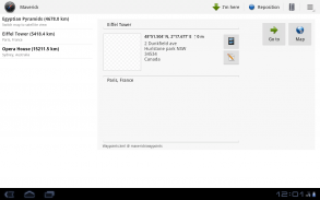
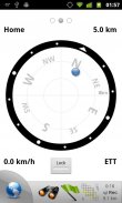
Build-in radar shows the direction, distance and estimated time to a point of interest.
• Save places you visit
All waypoint stored in KML file and can be viewed and edited in Google Earth.
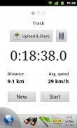
• Record tracks with single tap
Tracks are recorded in GPX format and can be viewed in Google Earth and other software.
• Upload tracks to GPSies
Free account is required for uploading.
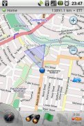
• Trip Computer
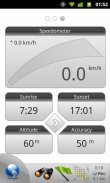
Watch speed, altitude, pitch and many other values.
Only in Pro version:
• Unlimited waypoints and tracks
• Lock compass to bearing
• UTM and OSGB grids
• OS Explorer maps
• FourSquare support
We can implement standard Google MapView, but it's limited - no caching and terrain view. If you need it, please email us or leave a comment.
</div> <div jsname="WJz9Hc" style="display:none">Utilice mapas fuera de línea y GPS incluso sin conexión a Internet. Esta aplicación es ideal para practicar senderismo, paseos en bote, geocaching y otras actividades al aire libre.
• Múltiples mapas online globales y regionales, entre ellos: Bing, Yandex, Open Street Maps, Ciclo OSM, OSM Transporte público, Multimap (Reino Unido), OutdoorActive (Alemania, Austria, Tirol del Sur), Cykloatlas, HikeBikeMap (Alemania), Open Piste Mapa , NearMap (Australia) y muchos otros mapas.
Todos los mapas en caché de forma automática para uso sin conexión. Utilice Mobile Atlas Creator para descargar mapas o MAPC2MAPC para convertir mapas de otros formatos.
• Comparta su posición actual o en proyecto
Puede enviar direcciones, coordenadas GPS, enlace a Google Maps e incluso un mapa de imagen.
• Navegar fácilmente
Radar Construir-en la muestra la dirección, distancia y tiempo estimado para un punto de interés.
• Guardar lugares que visita
Todo waypoint almacenado en el archivo KML y se puede ver y editar en Google Earth.
• Las pistas de registro con solo toque
Las pistas se graban en formato GPX y se pueden ver en Google Earth y otro software.
• Subir pistas para GPSies
Cuenta gratuita se requiere para la carga.
• Computadora de viaje
Ver la velocidad, la altitud, el tono y muchos otros valores.
Sólo en la versión Pro:
• waypoints ilimitadas y pistas
• brújula Bloquear para rodamiento
• UTM y OSGB rejillas
• Mapas OS Explorador
• Apoyo FourSquare
Podemos implementar estándar de Google MapView, pero es limitada - no el almacenamiento en caché y el terreno vista. Si lo necesita, por favor envíenos un correo electrónico o dejar un comentario.</div> <div class="show-more-end">


